Mapping Defeat
 Andrew Sullivan has some cool maps on his site today showing the contraction of Palestinian land from 1946 through 2010.
Andrew Sullivan has some cool maps on his site today showing the contraction of Palestinian land from 1946 through 2010.
He could have made the series even more impressive if he'd started in 1922, when some 2/3rds of the Palestine Mandate was shaved off to make the Kingdom of Transjordan.
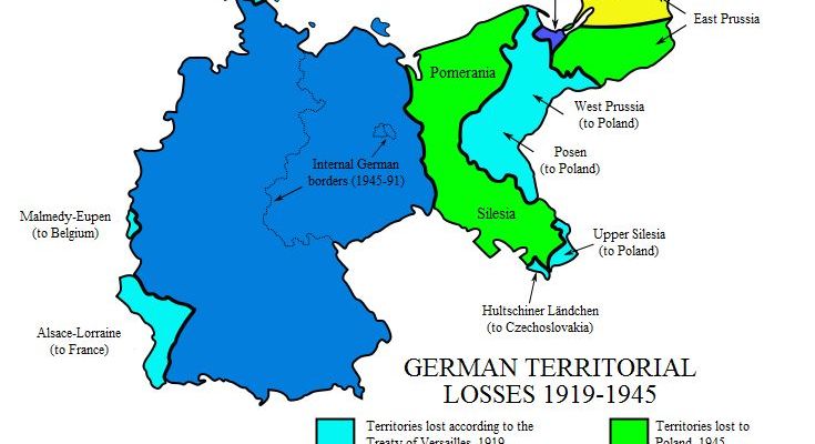
You know what else would make an impressive series of contracting maps? A map of the loss of German land to Poles and others that compared the boundaries of Germany in 1914, 1920 and 1945.
Hungary could tell a similar story.
I suppose the moral of the story is: If you want to keep your lands, don't start wars. If you start wars, don't lose them. And if you start wars and lose them - as the Palestinians and the Arab states did de jure or de facto in 1936, 1947, 1967, 1973 and 2000 ... well, don't expect a lot of sympathy afterward.


